Weather Forecast
Rain showers, and cooler temperatures. Chance for some afternoon thunder.
At a Glance

Today
Showers. Slight chance for afternoon thunder SLV
50s Near 60 in St. Lawrence Valley.

Tonight
Showers likely, decreasing overnignt.
Mid 40s, Low 50s in SLV

Monday
Scattered AM showers. Increasing PM sun.
Mid 60s - low 70s.

Tuesday
Mostly sunny.
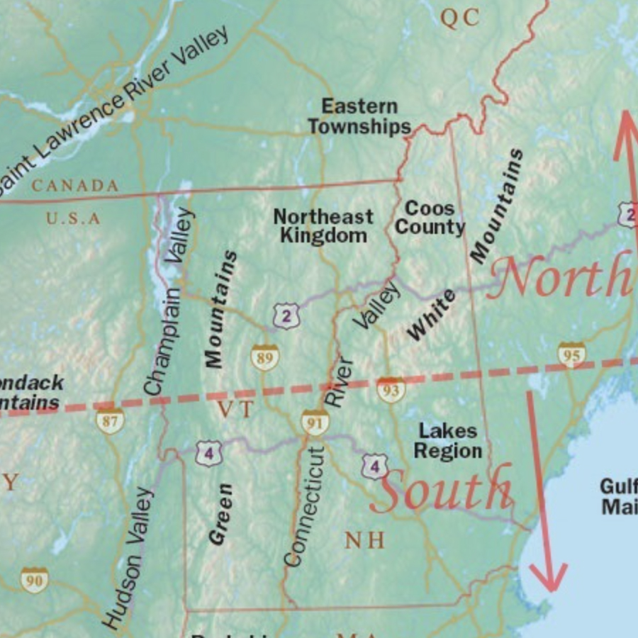
Mid 60s Near 70 North, Mid 70s South.
Eye on the Sky Forecast, May 5, 2024
Weather Forecast
Extended Forecast | Significant/Hazardous Weather | Recreational Forecast | Detailed Discussion | Farm & Garden | Wind by Elevation | Temperature by Elevation
Detailed Forecast
Today:
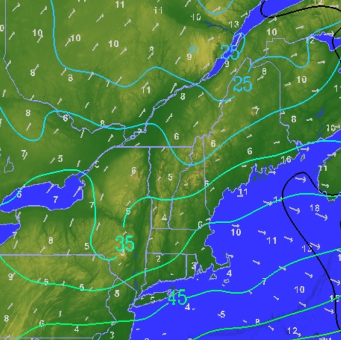
Showers spreading to New Hampshire by midday. Slight chance of thunderstorms in the afternoon for northern NY and the St. Lawrence Valley. Cool. Highs in the 50s from the Green Mountains east, and 55-60 west. Wind south near 10 mph east, and 10 to 15 mph, gusting to 25 mph from the Green Mountains west.
Tonight:
Showers decreasing west to east overnight. Lows in the mid 40s from the Green Mountains east, and the upper 40s west. Low 50s in the St. Lawrence Valley.
Monday:
Morning clouds, with scattered showers mainly from the Adirondacks and Rt. 2 north, mostly over the higher terrain. Then increasing afternoon sun. Highs in the 60s to near 70 north, in the low to mid 70s south.
Extended Forecast
Monday Night:
Clear. Lows in the upper 30s to upper 40s.
Tuesday:
Mostly sunny. Highs in the mid 60s to near 70 north, in the low to mid 70s south.
Tuesday Night:
Becoming mostly cloudy. Scattered showers developing. Lows in the mid 40s north, upper 40s to near 50 west and south.
Wednesday:
Showers likely. Highs in the mid 60s to 70.
Wednesday Night:
Chance of showers. Lows in the mid to upper 40s.
Thursday:
Chance of showers. Highs in the low to mid 60s, upper 60s in the St. Lawrence and Connecticut Valleys.
Significant/Hazardous Weather
None.
Recreational Forecast
Mountain Forecast:
Today: Showers beginning in the morning over the Green Mountains and Adirondacks, reaching the White Mountains by midday. Afternoon showers likely to increase in intensity over higher elevations with the potential for some thunderstorms.
Monday: Chance of showers throughout the morning, with summits obscured in rain and clouds. Clouds decreasing throughout the late afternoon into the evening. Consult forecast tables for wind and temperature at specific elevations.
Wind At Lower Elevations:
Today, moderate south winds becoming southwest near 20 mph. Monday, west wind shifting to northwest decreasing throughout the day to 10mph.
For more details on Lake Champlain, go to: https://forecast.weather.gov/product.php?site=BTV&product=REC&issuedby=BTV
Detailed Discussion
A cold front currently over the western Great Lakes will move through the region today. Strong south westerly flow will advect moisture from the Gulf of Mexico supporting widespread showers. On Sunday afternoon around 2pm a layer of unstable air has the potential to move into eastern New York supporting the formation of isolated thunderstorms. As this air moves eastward there is a chance for thunderstorms over higher elevations such as the White Mountains.
The crest of the moisture will move through the area by Sunday evening, reducing showers throughout the region. On Monday morning scattered showers continue as the cold front moves eastward. A high pressure system begins to settle into the area Monday night into Tuesday morning. Partly cloudy skies and warm temperatures move in with highs near 70 across the region. The next chance for showers will be Wednesday as an Alberta clipper heads our way.
Farm & Garden
Rainfall Forecast:
8 a.m. Sunday until 8 a.m. Monday: Showers likely all day Sunday from the Green Mountains west; and from late morning on east of the Green Mountains through New Hampshire. Widespread showers tapering off by midnight from west to east. Amounts .50-.75″; spot amounts to 1.00″ in a few thunderstorms over eastern New York, and over higher elevations.
8 a.m. Monday until 8 a.m. Tuesday: Scattered showers Monday morning through Monday midday with cold frontal passage. Amounts .25″ or less. Coverage 30-40%.
8 am Tuesday until 8 a.m. Wednesday: Showers moving in Tuesday evening west to east, with widespread showers by Wednesday morning. Amounts .25″ or less. Coverage 30-40%.
Drying Conditions:
Poor drying conditions region-wide on Sunday with general showers and minimum relative humidity near 80 percent. Drying improves to fair to good with some clearing and warmer temperatures Monday. Good drying Tuesday. Poor drying conditions return on Wednesday with region wide showers and relative humidity in the mid 70s.
Frost:
No frost or freezing temperatures over the next several days.
Wind by Elevation
| Wind Speeds | |||
|---|---|---|---|
| Elevation | Today | Monday | Tuesday |
| 2000ft | SSE 10 to 25 mph | NW 5 to 10 mph | NW 5 to 10 mph |
| 4000ft | S>SW 20 to 35 mph | WNW 10 to 15 mph | NW 10 to 15 mph |
| 6000ft | S>W 25 to 40 mph | WNW 15 to 25 mph | NW 25 to 35 mph |
Temperature by Elevation
| Temperature at Elevation | |||
|---|---|---|---|
| Elevation | Today | Monday | Tuesday |
| 2000ft | near 50 | 50 to 55 | 55 to 60 |
| 4000ft | 40 to 45 | 40 to 45 | 45 to 50 |
| 6000ft | 30s | near 40 | near 40 |
Weather Journal
May 5, 2024
Sunrise: 5:36 AM
Sunset: 7:59 PM
Length of the day:
14 hours and 23 minutes
A late season nor’easter was finishing up on this date, over 200 years ago in 1812. Rain changed to snow as far south as Philadelphia, while the higher elevations in southern Vermont contended with a heavy, wet snowfall. According to the New Hampshire Sentinel from Keene, the snow “lay 10 to 12 inches deep on the high lands.”
Current Conditions Maps – Quick Links

This program is a partnership between the Fairbanks Museum and Vermont Public.


